Full-Service.
SERVICES
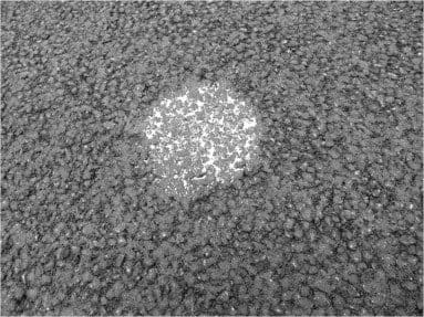
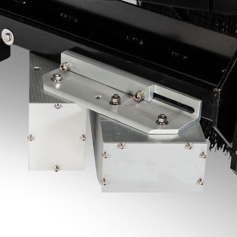
Macrotexture Data Collection
Macrotexture Data Collection provides identification of changes in pavement surface height larger than 0.5mm on a network level. When combined with other data sets, macrotexture data collection can provide valuable pavement texture information with the intention of identifying areas with the potential for hydroplaning.


Right-of-Way Image Collection
The three forward-facing cameras create panoramic-like images that provide a high-resolution visual reference that is extremely important when evaluating the condition of the roadway infrastructure within the network.
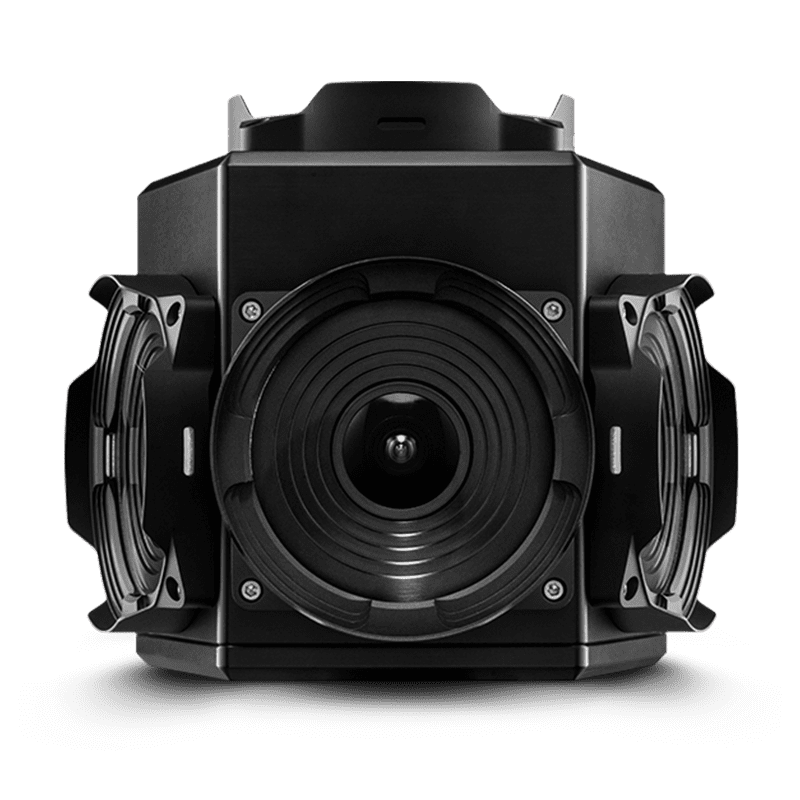
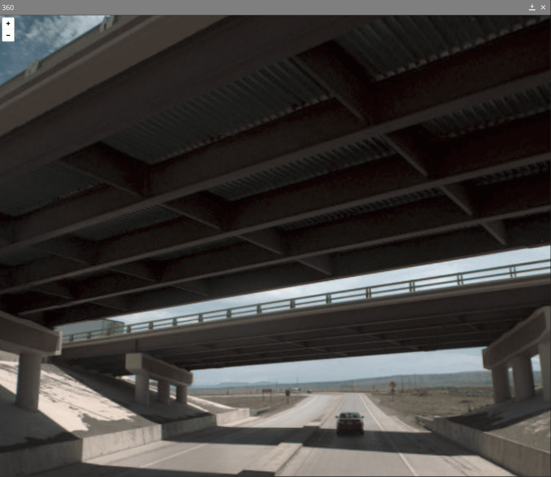
360º Spherical Image Collection
Pathway Services 360° Spherical Imaging Subsystem integrates a 6-camera array, producing a spherical image export for enhanced asset inventory attribution. The 30 MP CMOS camera system allows for the identification for elements not visible from the Right-of-Way imaging system.
Industry Research
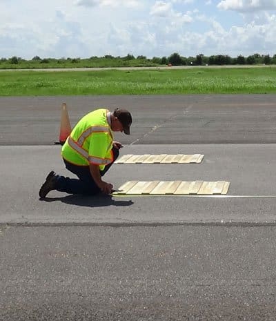
From the very beginning, Pathway Services has been a participant and supporter of many industry research projects and there is so much more on the way!
Our fleet of PathRunners operate the same hardware and software systems as those custom configured for our clients, giving our engineers intimate design knowledge and vast experience in subsystem troubleshooting, and our clients more immediate access to replacement hardware and support.
Whether it’s one of our many collection projects or an agency collecting with a short window of opportunity, we know how valuable it is to maintain a project schedule. The PathRunner support line ensures connection to our engineers through call forwarding and messaging systems. The Pathway Services extended warranty includes in-field repairs for system failures.
Pathway Services is located in the center of the country so technicians can reach any state and often perform repairs within 48 hours. We will meet you where you are and get you fixed, calibrated, and collecting in no time.
- South Dakota-styled Inertial Profiler
- TPP 3D System Certification
- PSI File Format
- 3-Zone High Density Microtexture
Third-Party Collaboration
Successful and optimized data collection in the pavement industry requires collaboration between entities such as auditors, universities, contract administration services, certification institutes, and more. Our customer support extends beyond each Pathway Services client and includes parties with influence over collected data. We’re grateful to build relationships with each of these supporting agencies and industry partners around the world.
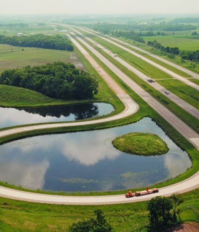
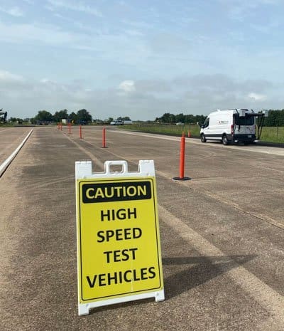
Pathway Services has the largest fleet of TTI and NCAT-certified vehicles in the industry. The company is also participating in the development of a universal file format (.PSI), in a TPP study for certifying 3D pavement analysis systems, and in pavement preservation monitoring in the northern and southern test track facilities at MnROAD and NCAT.
Cooperative Agencies
- Texas Transportation Institute (TTI) - Certification and TPP studies
- National Center for Asphalt Technologies (NCAT) - Certification and Preservation Studies
- InTrans - 3rd party auditor
- Quality Engineering Solutions - 3rd Party auditor
- HNTB - 3rd party auditor


Extended Warranty Service
24-hour response time! A difficult reality with technology is that will eventually be required, but our engineers are dedicated to getting you back up and running as quickly as possible.
Data saturation can become a burden quickly. Our database management team and server storage capacity rivals that of Azure and Google. We empower our clients by giving them flexible options and offering highly secure data hosting plans that meet the individual project needs.
- Annual subsystem and computer maintenance and calibration
- On-site and Remote Training and Support
- 24-hour emergency response guarantee
- File Maintenance, Hardware Inspection and Maintenance, Software and Firmware Updates
- Software Upgrades provided at no cost
- Custom Software modifications
- Emergency Data Collection and Vehicle support
- Warranty replacement coverage for all subsystems and related components
- Spare parts provided: DMI, RAM, Keyboard and Mouse, Reflectors
- 10-year minimum extended warranty coverage available

Data Hosting
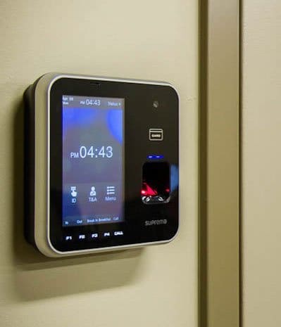
Data flexibility and redundancy could be our middle names. Let us handle the data storage and security so your agencies can focus on data analysis, network performance and safety.
Data saturation can become a burden quickly. Our database management team and server storage capacity rivals that of Azure and Google. We empower our clients by giving them flexible options and offering highly secure data hosting plans that meet the individual project needs.
- AIPCA SOC 1 Certified Data Hosting Facility
- Biometric Security
- Motion-Activated Security Monitoring
- 13" thick razor-wired exterior walls with 24/7 armed physical security
- Environmental Monitoring including temperature, humidity, moisture and sound
- Water-proof barrier over floors protecting against water intrusion
- Emergency Power Generator

DQMP Development and Support
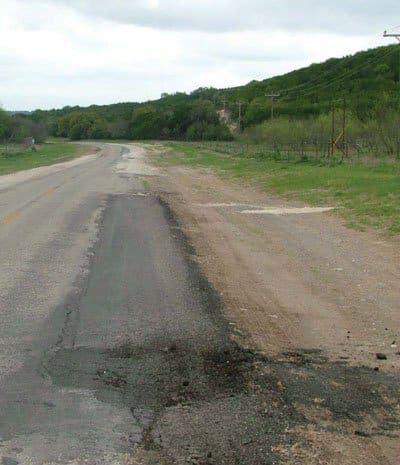
Data quality is our top priority. We help establish and support DQMPs around the nation to assist each agency in meeting and exceeding all federal requirements through protocol, accuracy, and repeatability.
Built-in to our company’s services is the culture to go above and beyond all Data Quality Management Plan requirements and supporting documentation needs. Our Pathway Services data collection teams perform and document daily PathRunner checks, weekly state assigned validation collections, and monthly data verification sites. PathRunners receive quarterly or pre-collection 360 checks, and many are annually certified at 3rd-party entities such as TTI and NCAT.
- .23 CFR 490.319(c)
- AASHTO M32ti-14
- AASHTO R57-14
- AASHTO R43-13
- AASHTO R4ti-10
- AASHTO R55-10
- AASHTO R56-14
- AASHTO PP67-14
- AASHTO PP6ti-14
- AASHTO PP69-14
- AASHTO PP70-14
- HPMS Field Manual
- Equipment Calibration and Certification
- In-field Certification prior to Data Collection
- Data Quality measures taken prior to a periodically during the data collection cycle
- Data Sampling, Review and Checks
- Error resolution processes
| Data Element |
Required Minimum Accuracy |
Required Resolution (Measure to the Nearest) | Required Minimum Repeatability |
| International Roughness Index | ± 5 percent compared to a reference profiler | 1 in/mi (0.02 m/km) | ± 5 percent run to run for three repeat runs |
| Rut Depth | ± 0.0ti in (2.0 mm)
compared to manual survey |
0.01 in (0.25 mm) | ± 0.0ti in (2.0mm)
run to run for three repeat runs |
| Faulting | ± 0.0ti in (2.0 mm)
compared to manual survey |
0.01 in (0.25 mm) | ± 0.0ti in (2.0mm)
run to run for three repeat runs |
| Distress Ratings | ± 10 percent compared to agency ratings | N/A | N/A |
| GPS Coordinates | 0.00005 degrees compared to agency provided coordinates | 0.000001 degree | N/A |
Ground Penetrating Radar Data Collection
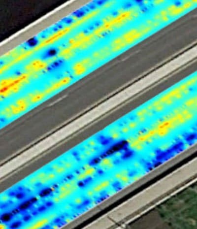
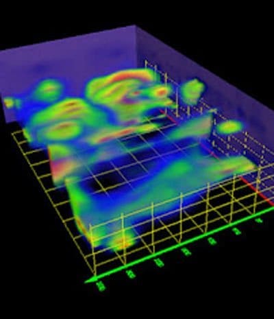
Pathway Services offers mobile Ground Penetrating Radar surveys, capturing below-ground feature density variance to identify pavement layer thickness, roadway asset infrastructure, and sub-surface anomalies.
GPR is a safe, non-destructive and cost-effective way to map subsurface characteristics of the road, detecting metal and non-metal objects, voids and other underground irregularities. Reflected high-frequency radio frequencies are evaluated to identify and measure dimensions, depth and thickness of rebar and dowel rods, public utilities, pipes, void spaces and sinkholes and more.
- 3' depth reading
- 2GHz Horn Antennae
- Wheel-mounted DMI
- 900 GB internal memory integrated GPS
- 256 Color Bins representing amplitude and polarity
- User-selectable Scan Rate
- IIR and FIR High and Low Pass Real-Time Filtering
- Operating Temp: 14ºF - 122ºF
Skid Resistance Data Collection
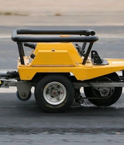
When it comes to roadway safety, the value of understanding resistance to skid cannot be underestimated. Collecting skid data is time-consuming and demanding, so why not let us collect the data for you? We offer statewide skid data collection so you can make the decisions necessary to keep your motorists safe and on the road.
Quantifying skid resistance considers the interaction between a vehicle’s tire and the pavement on both a macrotexture (large-scale texture defining the potential for the redistribution of water from the surface) and microtexture (small-scale texture defining the contact that exists between the tire and the pavement). Year-over-year or seasonal analysis can provide information with regard to pavement water and aggregate polishing and the effects of climate on tire and pavement composition.
- Locked Wheel testing on dry pavement
- AASHTO M261 and ASTM E501
- 40 mph testing speed
Texture Signature Data Collection (Coming Soon)
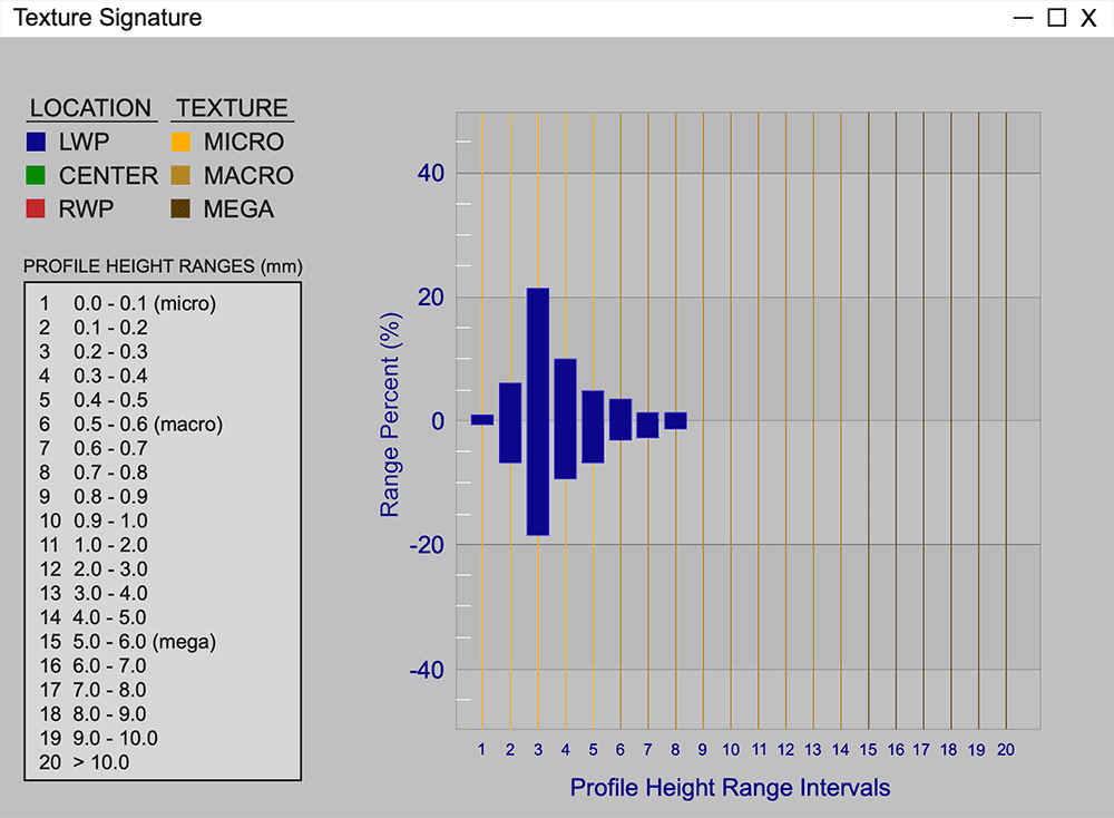
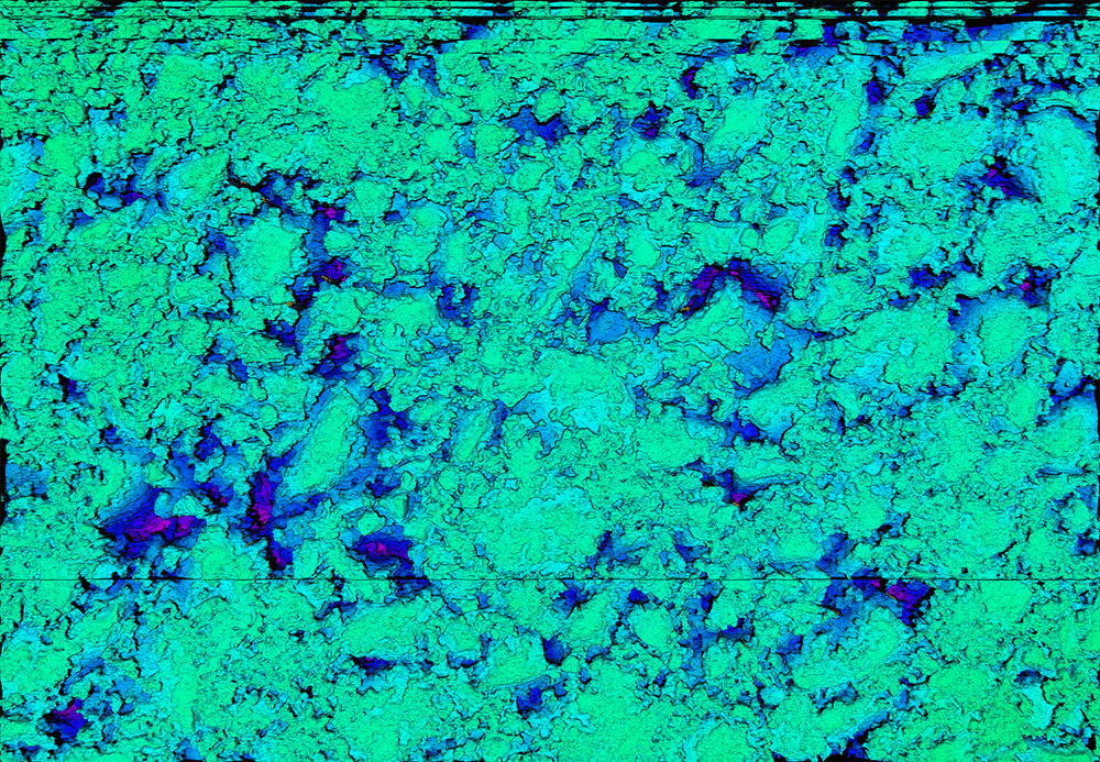
Pathway Services has pioneered a NEW, ground-breaking high-density 3-zone Texture Signature system that is changing the way the industry evaluates pavement texture. Pavement signatures combined with road geometries will help redefine “safe” and potentially help reduce texture-related incidents on your network.
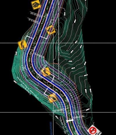
Surface height changes calculated at the microtexture level in the LWP, Center and RWP are used to determine pavement deterioration by zone and using year-over-year analysis. Texture profiles and road geometry combine to flag network locations presenting potential texture-related risk areas considering standard tire composition and performance.
Contact Pathway Services for more information.
Asset Extraction
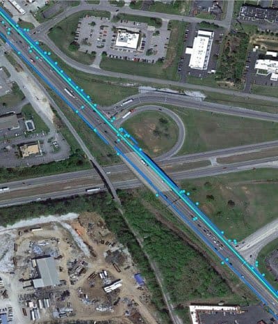
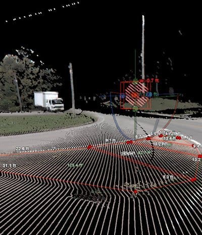
Let us inventory your asset infrastructure from the ground up, capturing each roadway feature spatially, at a moment in time, and with full attribution for your maintenance, modeling, planning, and safety analysis needs.
Network-level asset inventory extraction can be a daunting prospect to any agency, which is why Pathway Services has dedicated teams and customized tools developed over many years to make asset collection quick and thorough. We provide you with over 35 unique asset guides to start each of your asset inventory projects with proven extraction guidelines and the premier image sampling to build customized data dictionaries for final reporting formats. Along the way, we will use your specific feature types and routing methods to design a scope that meets all department needs and will support DQMP references for QA purposes. At Pathway Services, we provide the most comprehensive asset data to our clients. The extraction technology may rely on our HD camera systems or colorized HD LiDAR scanning units. We work with each client pr asset type to determine a methodology that best suites the accuracy and attribution needs for the project. Automated and semi-automated tools make extraction reliable and repeatable. Reporting formats adapt to each project with shape files, KMZ, .csv, .xsls, and .txt files all standard file types available for export.
Technologies:
- HD Cameras (Forward -facing Panoramic and Rear-facing)
- HD LiDAR
- DMI
- GPS + IMU
Methodologies:
- MIRE
- HPMS
- Map-21
- Fast Act

LiDAR Data Collection
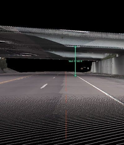
Pathway Services provides LiDAR mobile mapping data collection services using the highest quality LiDAR scanner and an integrated camera array for parallax-free colorization. The high performance of this survey grade single-scanner LIDAR subsystem provides the most precise and accurate data without the need for bore sighting calibration and limited post-processing requirements.
For efficiency and flexibility, we collect HD LiDAR as a subsystem integrated on the PathRunner along with typical network collection, or as a dedicated mobile LiDAR unit for leaf-off season or specialty projects. Inherent to our LiDAR data collection services are processing, compressing, and hosting the point cloud data for a simplified turn-key operation. HD LiDAR scanning units can include dedicated cameras for point cloud colorization, enhancing data manipulation to improve analysis and extraction processes. Once collected, our clients own the point cloud data for viewing and continued analysis in our web-based software, PathPoints, or to integrate into their existing platforms via standardized file formats.
- SCAN RATE: 1M points / second
- RANGE: 119m
- RANGE RESOLUTION: 0.1mm
- RANGE DRIFT: < 2mm
- ROTATION SPEED: 200 profiles / second
- FIELD OF VIEW: 360 degrees
- OPERATING TEMPERATURE: -10 to 45 C
- PROTECTION CLASS: IP54, Eye Safe Class 1 Laser
- No Post-Processing Required
- SYSTEM OPERATION: Real Time
Pavement Condition Data Collection
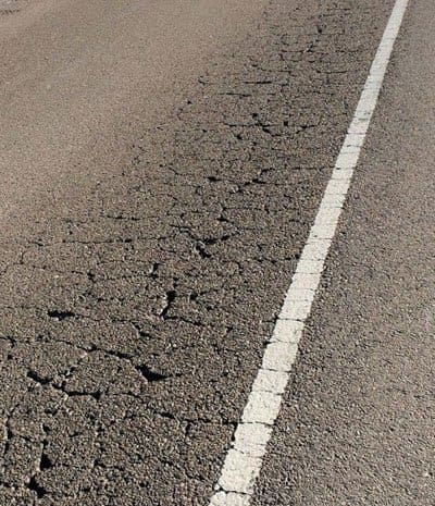
Millions of miles of pavement and years of experience has made Pathway Services the industry leader in pavement condition collection services in the United States and beyond. Our automated pavement condition surveys are designed to adapt to each client’s unique requirements while maintaining set standards such as HPMS reporting and more.
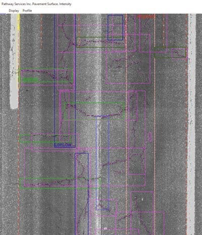
Our 3D subsystems, both the legacy Pathway 3D and second-generation 3D- PAS, capture a linescan-like image while also storing a depth value for every collected pixel, resulting in both a photo and scan of the road to isolate differences in height for surface characteristics. The finished product creates a continuous 3D scan of the road that our software solutions then analyze with automated tools for cracking, rutting, faulting, and many other distresses. This system is used by more than 50% of USDOTs to collect these data types and exceeds all technical specifications such as AASTHO R36-13, PP 69, and PP 70.
3D Pavement Scanning with Legacy Pathway 3D or Second-Generation 3D-PAS System
- Transverse Profile AASHTO
- 3D Faulting Analysis
- Automated Lane Location Zones
- Continuous Rut-Depth Measurements
- Automated Crack Detection
- Automated Edge Drop-Off Values
- Lane Cross-Slope
Condition Indices
- IRI
- MIRI
- PCI
- RN
- Customized Deductions
Pavement Condition Reporting
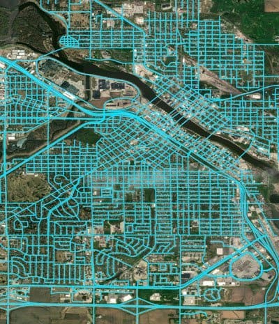
HPMS pavement condition annual reports and other state-requested customizations for statewide pavement condition management are our specialty. Pathway Services supports 1/2 of the nation by providing simple interface solutions and single-click exports to non-proprietary .csv files.
PathRunners are equipped with the latest technology, integrated for continuous data collection and network-level roadway analysis. Onboard assistance features in each PathRunner enhance data quality by alerting teams of potential data quality concerns, GPS location notifications, of subsystems status in advance of critical errors, and numerous other safety reminders. The voice-animated system promotes in-field efficiencies and lower re-collection percentages in each project.
While collecting an agency’s network, our team will provide:
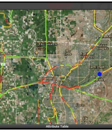
- Daily Project Tracking Maps
- Weekly Progress Reports
- Weather Advisories
- GPS Route Corrections
See our “Technical” page for subsystem information.
ABOVE & BEYOND
Macrotexture Data Collection
Macrotexture Data Collection provides identification of changes in pavement surface height larger than 0.5mm on a network level. When combined with other data sets, macrotexture data collection can provide valuable pavement texture information with the intention of identifying areas with the potential for hydroplaning.


Right-of-Way Image Collection
The three forward-facing cameras create panoramic-like images that provide a high-resolution visual reference that is extremely important when evaluating the condition of the roadway infrastructure within the network.


360º Spherical Image Collection
Pathway Services 360° Spherical Imaging Subsystem integrates a 6-camera array, producing a spherical image export for enhanced asset inventory attribution. The 30 MP CMOS camera system allows for the identification for elements not visible from the Right-of-Way imaging system.


Industry Research
From the very beginning, Pathway Services has been a participant and supporter of many industry research projects and there is so much more on the way!
Our fleet of PathRunners operate the same hardware and software systems as those custom configured for our clients, giving our engineers intimate design knowledge and vast experience in subsystem troubleshooting, and our clients more immediate access to replacement hardware and support.
Whether it’s one of our many collection projects or an agency collecting with a short window of opportunity, we know how valuable it is to maintain a project schedule. The PathRunner support line ensures connection to our engineers through call forwarding and messaging systems. The Pathway Services extended warranty includes in-field repairs for system failures.
Pathway Services is located in the center of the country so technicians can reach any state and often perform repairs within 48 hours. We will meet you where you are and get you fixed, calibrated, and collecting in no time.
- South Dakota-styled Inertial Profiler
- TPP 3D System Certification
- PSI File Format
- 3-Zone High Density Microtexture


Third-Party Collaboration
Successful and optimized data collection in the pavement industry requires collaboration between entities such as auditors, universities, contract administration services, certification institutes, and more. Our customer support extends beyond each Pathway Services client and includes parties with influence over collected data. We’re grateful to build relationships with each of these supporting agencies and industry partners around the world.
Pathway Services has the largest fleet of TTI and NCAT-certified vehicles in the industry. The company is also participating in the development of a universal file format (.PSI), in a TPP study for certifying 3D pavement analysis systems, and in pavement preservation monitoring in the northern and southern test track facilities at MnROAD and NCAT.
Cooperative Agencies
- Texas Transportation Institute (TTI) - Certification and TPP studies
- National Center for Asphalt Technologies (NCAT) - Certification and Preservation Studies
- InTrans - 3rd party auditor
- Quality Engineering Solutions - 3rd Party auditor
- HNTB - 3rd party auditor


Extended Warranty Service
24-hour response time! A difficult reality with technology is that will eventually be required, but our engineers are dedicated to getting you back up and running as quickly as possible.
Data saturation can become a burden quickly. Our database management team and server storage capacity rivals that of Azure and Google. We empower our clients by giving them flexible options and offering highly secure data hosting plans that meet the individual project needs.
- Annual subsystem and computer maintenance and calibration
- On-site and Remote Training and Support
- 24-hour emergency response guarantee
- File Maintenance, Hardware Inspection and Maintenance, Software and Firmware Updates
- Software Upgrades provided at no cost
- Custom Software modifications
- Emergency Data Collection and Vehicle support
- Warranty replacement coverage for all subsystems and related components
- Spare parts provided: DMI, RAM, Keyboard and Mouse, Reflectors
- 10-year minimum extended warranty coverage available


Data Hosting
Data flexibility and redundancy could be our middle names. Let us handle the data storage and security so your agencies can focus on data analysis, network performance and safety.
Data saturation can become a burden quickly. Our database management team and server storage capacity rivals that of Azure and Google. We empower our clients by giving them flexible options and offering highly secure data hosting plans that meet the individual project needs.
- AIPCA SOC 1 Certified Data Hosting Facility
- Biometric Security
- Motion-Activated Security Monitoring
- 13" thick razor-wired exterior walls with 24/7 armed physical security
- Environmental Monitoring including temperature, humidity, moisture and sound
- Water-proof barrier over floors protecting against water intrusion
- Emergency Power Generator


DQMP Development and Support
Data quality is our top priority. We help establish and support DQMPs around the nation to assist each agency in meeting and exceeding all federal requirements through protocol, accuracy, and repeatability.
Built-in to our company’s services is the culture to go above and beyond all Data Quality Management Plan requirements and supporting documentation needs. Our Pathway Services data collection teams perform and document daily PathRunner checks, weekly state assigned validation collections, and monthly data verification sites. PathRunners receive quarterly or pre-collection 360 checks, and many are annually certified at 3rd-party entities such as TTI and NCAT.
- .23 CFR 490.319(c)
- AASHTO M32ti-14
- AASHTO R57-14
- AASHTO R43-13
- AASHTO R4ti-10
- AASHTO R55-10
- AASHTO R56-14
- AASHTO PP67-14
- AASHTO PP6ti-14
- AASHTO PP69-14
- AASHTO PP70-14
- HPMS Field Manual
- Equipment Calibration and Certification
- In-field Certification prior to Data Collection
- Data Quality measures taken prior to a periodically during the data collection cycle
- Data Sampling, Review and Checks
- Error resolution processes
| Data Element |
Required Minimum Accuracy |
Required Resolution (Measure to the Nearest) | Required Minimum Repeatability |
| International Roughness Index | ± 5 percent compared to a reference profiler | 1 in/mi (0.02 m/km) | ± 5 percent run to run for three repeat runs |
| Rut Depth | ± 0.0ti in (2.0 mm)
compared to manual survey |
0.01 in (0.25 mm) | ± 0.0ti in (2.0mm)
run to run for three repeat runs |
| Faulting | ± 0.0ti in (2.0 mm)
compared to manual survey |
0.01 in (0.25 mm) | ± 0.0ti in (2.0mm)
run to run for three repeat runs |
| Distress Ratings | ± 10 percent compared to agency ratings | N/A | N/A |
| GPS Coordinates | 0.00005 degrees compared to agency provided coordinates | 0.000001 degree | N/A |


Ground Penetrating Radar Data Collection
Pathway Services offers mobile Ground Penetrating Radar surveys, capturing below-ground feature density variance to identify pavement layer thickness, roadway asset infrastructure, and sub-surface anomalies.
GPR is a safe, non-destructive and cost-effective way to map subsurface characteristics of the road, detecting metal and non-metal objects, voids and other underground irregularities. Reflected high-frequency radio frequencies are evaluated to identify and measure dimensions, depth and thickness of rebar and dowel rods, public utilities, pipes, void spaces and sinkholes and more.
- 3' depth reading
- 2GHz Horn Antennae
- Wheel-mounted DMI
- 900 GB internal memory integrated GPS
- 256 Color Bins representing amplitude and polarity
- User-selectable Scan Rate
- IIR and FIR High and Low Pass Real-Time Filtering
- Operating Temp: 14ºF - 122ºF


Skid Resistance Data Collection
When it comes to roadway safety, the value of understanding resistance to skid cannot be underestimated. Collecting skid data is time-consuming and demanding, so why not let us collect the data for you? We offer statewide skid data collection so you can make the decisions necessary to keep your motorists safe and on the road.
Quantifying skid resistance considers the interaction between a vehicle’s tire and the pavement on both a macrotexture (large-scale texture defining the potential for the redistribution of water from the surface) and microtexture (small-scale texture defining the contact that exists between the tire and the pavement). Year-over-year or seasonal analysis can provide information with regard to pavement water and aggregate polishing and the effects of climate on tire and pavement composition.
- Locked Wheel testing on dry pavement
- AASHTO M261 and ASTM E501
- 40 mph testing speed


Texture Signature Data Collection (Coming Soon)
Pathway Services has pioneered a NEW, ground-breaking high-density 3-zone Texture Signature system that is changing the way the industry evaluates pavement texture. Pavement signatures combined with road geometries will help redefine “safe” and potentially help reduce texture-related incidents on your network.
Surface height changes calculated at the microtexture level in the LWP, Center and RWP are used to determine pavement deterioration by zone and using year-over-year analysis. Texture profiles and road geometry combine to flag network locations presenting potential texture-related risk areas considering standard tire composition and performance.
Contact Pathway Services for more information.


Asset Extraction
Let us inventory your asset infrastructure from the ground up, capturing each roadway feature spatially, at a moment in time, and with full attribution for your maintenance, modeling, planning, and safety analysis needs.
Network-level asset inventory extraction can be a daunting prospect to any agency, which is why Pathway Services has dedicated teams and customized tools developed over many years to make asset collection quick and thorough. We provide you with over 35 unique asset guides to start each of your asset inventory projects with proven extraction guidelines and the premier image sampling to build customized data dictionaries for final reporting formats. Along the way, we will use your specific feature types and routing methods to design a scope that meets all department needs and will support DQMP references for QA purposes. At Pathway Services, we provide the most comprehensive asset data to our clients. The extraction technology may rely on our HD camera systems or colorized HD LiDAR scanning units. We work with each client pr asset type to determine a methodology that best suites the accuracy and attribution needs for the project. Automated and semi-automated tools make extraction reliable and repeatable. Reporting formats adapt to each project with shape files, KMZ, .csv, .xsls, and .txt files all standard file types available for export.
Technologies:
- HD Cameras (Forward -facing Panoramic and Rear-facing)
- HD LiDAR
- DMI
- GPS + IMU
Methodologies:
- MIRE
- HPMS
- Map-21
- Fast Act


LiDAR Data Collection
Pathway Services provides LiDAR mobile mapping data collection services using the highest quality LiDAR scanner and an integrated camera array for parallax-free colorization. The high performance of this survey grade single-scanner LIDAR subsystem provides the most precise and accurate data without the need for bore sighting calibration and limited post-processing requirements.
For efficiency and flexibility, we collect HD LiDAR as a subsystem integrated on the PathRunner along with typical network collection, or as a dedicated mobile LiDAR unit for leaf-off season or specialty projects. Inherent to our LiDAR data collection services are processing, compressing, and hosting the point cloud data for a simplified turn-key operation. HD LiDAR scanning units can include dedicated cameras for point cloud colorization, enhancing data manipulation to improve analysis and extraction processes. Once collected, our clients own the point cloud data for viewing and continued analysis in our web-based software, PathPoints, or to integrate into their existing platforms via standardized file formats.
- SCAN RATE: 1M points / second
- RANGE: 119m
- RANGE RESOLUTION: 0.1mm
- RANGE DRIFT: < 2mm
- ROTATION SPEED: 200 profiles / second
- FIELD OF VIEW: 360 degrees
- OPERATING TEMPERATURE: -10 to 45 C
- PROTECTION CLASS: IP54, Eye Safe Class 1 Laser
- No Post-Processing Required
- SYSTEM OPERATION: Real Time


Pavement Condition Data Collection
Millions of miles of pavement and years of experience has made Pathway Services the industry leader in pavement condition collection services in the United States and beyond. Our automated pavement condition surveys are designed to adapt to each client’s unique requirements while maintaining set standards such as HPMS reporting and more.
Our 3D subsystems, both the legacy Pathway 3D and second-generation 3D- PAS, capture a linescan-like image while also storing a depth value for every collected pixel, resulting in both a photo and scan of the road to isolate differences in height for surface characteristics. The finished product creates a continuous 3D scan of the road that our software solutions then analyze with automated tools for cracking, rutting, faulting, and many other distresses. This system is used by more than 50% of USDOTs to collect these data types and exceeds all technical specifications such as AASTHO R36-13, PP 69, and PP 70.
3D Pavement Scanning with Legacy Pathway 3D or Second-Generation 3D-PAS System
- Transverse Profile AASHTO
- 3D Faulting Analysis
- Automated Lane Location Zones
- Continuous Rut-Depth Measurements
- Automated Crack Detection
- Automated Edge Drop-Off Values
- Lane Cross-Slope
Condition Indices
- IRI
- MIRI
- PCI
- RN
- Customized Deductions


Pavement Condition Reporting
HPMS pavement condition annual reports and other state-requested customizations for statewide pavement condition management are our specialty. Pathway Services supports 1/2 of the nation by providing simple interface solutions and single-click exports to non-proprietary .csv files.
PathRunners are equipped with the latest technology, integrated for continuous data collection and network-level roadway analysis. Onboard assistance features in each PathRunner enhance data quality by alerting teams of potential data quality concerns, GPS location notifications, of subsystems status in advance of critical errors, and numerous other safety reminders. The voice-animated system promotes in-field efficiencies and lower re-collection percentages in each project.
While collecting an agency’s network, our team will provide:
- Daily Project Tracking Maps
- Weekly Progress Reports
- Weather Advisories
- GPS Route Corrections
See our “Technical” page for subsystem information.


