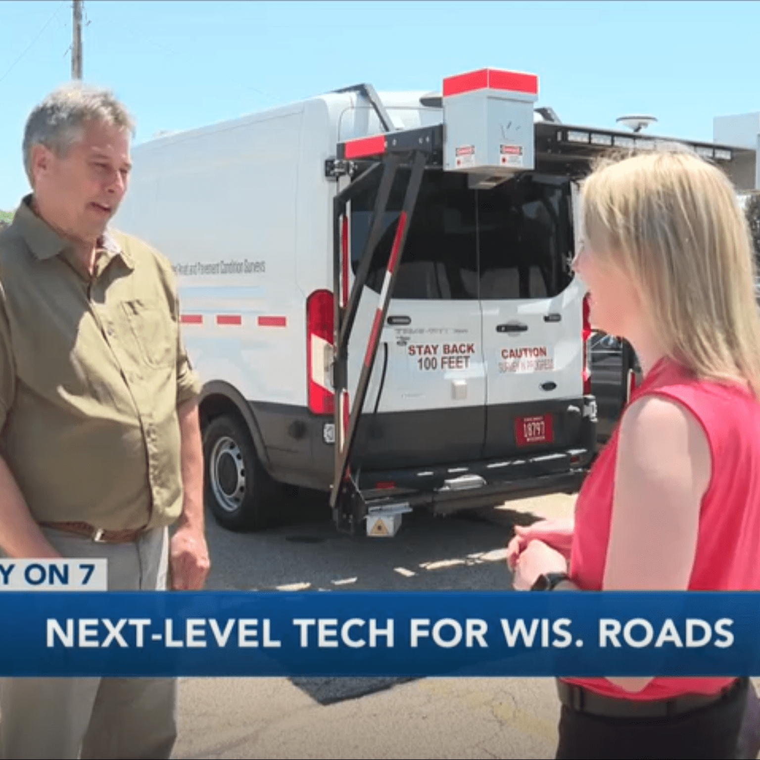
As lawmakers work to finalize the state's budget, the Department of Transportation is collecting and analyzing data using the latest technology. Think of the Google Maps car, but for road conditions. The DOT replaced its old data vehicles, or pavement profiler vans, with two new ones, aptly named the Coyote and Road Runner, in April of 2018 featuring the latest road analyzing technology. Each van has two sets of lasers: one set that takes 12-feet wide scans of the road collecting the type of pavement, severity of the condition, and amount of cracking, the other set scans the road for its roughness. The vans also have a GPS tracker, three computers, three forward-facing cameras, and a sensor that measures the distance from the sensor to the road and the speed the vehicle is moving. The vans each have two transportation specialists, one who drives and the other who focuses on collecting the best data possible. "One of the biggest differences (between the new vans and the previous ones), in the past we did sampling and we'd look at a sample of the pavement and determine the cracks based on the lidle sample and then project that out for the rest of the segment," Jeffrey Gust, DOT director of investment management said. "These vans are taking data every two millimeters as they're going down the road and so it's really a full set of data we're using.” The vans average 500 miles a week during the collection season, which is spring through fall. Annually, the vehicles will collect 47 terabytes of data over the 24,000 miles of state roads, which includes both directions. The data is converted into two measurements: the International Roughness Index and the Pavement Condition Index. The IRI is the measurement the Federal Highway Administration requires all states to collect. It essentially measures how rough the road is for drivers. Specifically, it measures "the amount of vertical movement a standard vehicle would experience," but it "does not identify underlying distresses causing the road condition."The PCI gives a better look at the condition of the road at the surface level and what the dynamics causing the condition. It was developed by the Army Corps of Engineers and is a nationally accepted standard for pavement assessment. A road can have opposite ratings with each scale. For example, a road could be very rough, but be in good condition. The attached examples show that difference. For PCI, the higher the number (on a scale of 0-100), the better the condition of the road (see the attached condition graph). For IRI, the higher the number the more rough the ride. An IRI rating of under 95"/mile is considered good, 95-170"/ mile is considered fair, and greater than that is considered poor. Asphalt and concrete pavements are rated differently. "We do both and they both matter," Gust noted. "A lot of drivers that's what they care about is the smoothness, but what we care about is how we can maximize the funds and fix the roads properly. And what PCI does is it looks at all individual distresses. It knows what types of cracks are in the road and it helps us determine what is the best fix for that type of cracking.” He added the data also helps them to prioritize which roads to fix, though priorities are slowly shiring. He explained the DOT is changing to prioritize maintaining roads to extend their life before they hit the point where their conditions will steeply decline and need major repairs or replacement (see the Typical Pavement Condition Life Cycle graphic). He said this will extend the life of the road, is less costly to do, and ultimately will save taxpayers money, but there are currently many roads that are in need of replacement. The data from the vans' first collection in 201ti will not be available until fall, but the DOT is analyzing that data and collecting 2019's for later on down the road.
PathRunner Subsystem Upgrades
NEW 3D System: 3D-PAS
NEW HD LiDAR System
NEW 3-Zone Texture Signature System
PathView II
Login to your account to download your latest version of PathView II from the software folder under “Resources”.
PathView
Version 6.2.10 (Released November 23, 2022)
PathWeb
Version 2.28.0 (Released July 25, 2022)
PathPoints
Version 2.67.7 (Released November 21, 2022)